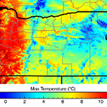

March 27, 2014 — The impacts of climate change are being felt around the world, but have you ever wondered how they might affect your neck of the woods? If so, the U.S. Geological Survey has a resource for you. The agency, in collaboration with Oregon State University, utilized data sets NASA created from climate models in the Intergovernmental Panel on Climate Change’s Fifth Assessment Report to create maps of the U.S. showing climate history and predictions down to the county level. NASA’s data set is known as the NASA Earth Exchange Downscaled Climate Projections, or NEX-DCP30. The USGS’s tool, aptly named the NEX-DCP30 Viewer, averages NASA’s temperature and precipitation data into 25-year increments to create one user-friendly package. Users can compare monthly high temperatures, low temperatures and rainfall predictions for their county through the end of the century. Interested in seeing what summer might feel like in 85 years where you live? Visit the NEX-DCP30 Viewer to find out.
Article by John Sisser.
Ensia shares solutions-focused stories free of charge through our online magazine and partner media. That means audiences around the world have ready access to stories that can — and do — help them shape a better future. If you value our work, please show your support today.
Yes, I'll support Ensia!