
February 4, 2016 —  Editor’s note: This Voices piece is published in collaboration with the academic journal Elementa. It is based on “Toward a digital resilience,” a peer-reviewed article published February 3 as part of Elementa’s Avoiding Collapse special feature.
If the bad news is that we’re living in a world in which resilience is more critical to survival than ever, the good news is that technology is more than ever providing the tools we need to cultivate resilience. Exciting innovations in digital data collection, analysis and visualization now allow us to track and understand human impacts at global to local scales and identify big-picture patterns and processes in ways never before possible, from the National Science Foundation’s Ocean Observatories Initiative, which measures physical, chemical, biological and geological variables throughout the depths of the ocean to the Global Earth Observation System of Systems, which provides petabytes of environmental data from space-borne, airborne and in situ sensors.
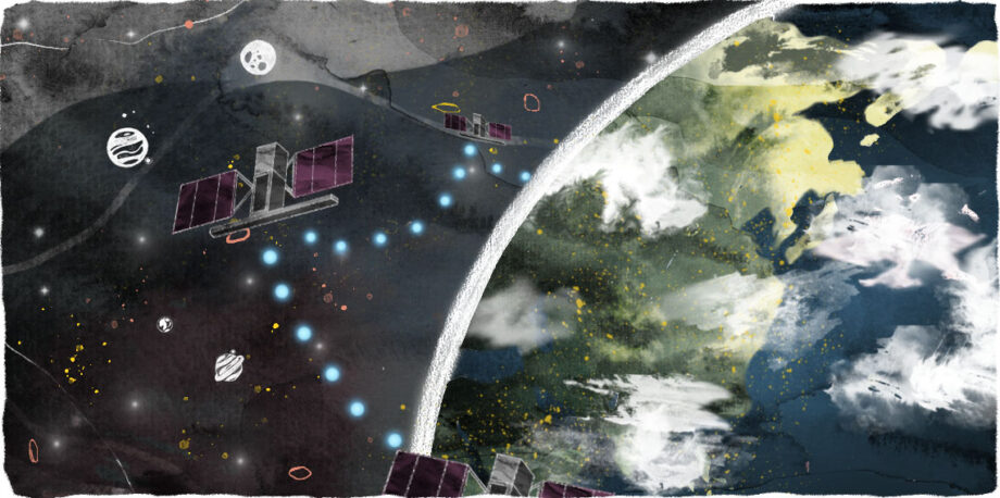
Indeed, we now find ourselves inhabiting a “Digital Earth” composed of technologies from satellites to wristwatches that monitor, map, model and manage virtually everything around us.
And it’s not just data for data’s sake. The same digital technologies we use to understand how the Earth works are also helping communities in very practical ways. These range from monitoring fire, drought or flooding to mapping the relevant insurance zones for such. They include tracking economic collapse or health epidemics, finding available drinking water, alerting us to temperature and precipitation changes, determining landscape vulnerability for land managers, monitoring air quality, even identifying the suitability of a position on one’s roof for installing solar panels.
The information such programs produce is precisely what we need to be able to cope with global change. But in order to use it to that end, we need to ensure it’s available to those who need it. In other words, we need to make sure the tools that allow us to gather and use this information are resilient, too. To that end, I propose a set of three principles that data generators should subscribe to and governments should adopt.
1. Share more than just data
To be of societal value, digital data must be tagged and analyzed, a practice commonly known as generating “metadata.” It also must be made available in a format that matches the user’s needs. We should not only share data openly, but also facilitate the use of data in a variety of ways. For example, temperature and precipitation data can be used not only to track or predict the effects of climate change but also to calculate how much energy is needed to cool a home or business in a specific region.
In making our data open to application by others, we need to be open about what we are doing with the data — the actual steps taken in an analysis or map preparation (aka “workflows”) — so others can replicate and validate (or improve upon) our work.
We also need to provide use cases — scenarios showing how and why data were used for a particular analysis or map, with an emphasis on a practical, real-world outcome. For example, a use case might tell the story of the correct or most effective way of using a particular workflow (i.e., the actual steps taken in an analysis or preparation of a map from initiation to completion), including how the data may be used in a range of formats, devices and platforms. If the reader of the use case is able to understand what is going on behind the scenes that produced a certain map or output, this will engender trust in the workflow and hence the results
2. Tell stories
Decades of studies in psychology have repeatedly shown how story affects the human mind and influences attitudes, fears, hopes and values. Storytelling is a valuable tool for taking the knowledge developed within academia and transmitting it into mainstream society in ways that resonate and empower action.
Scientists tend to want to explain how the world works by way of copious background information, overview of prior studies, detailed methods, results and discussion before getting to the take-home message. But policy-makers, journalists and the general public want the take-home message first. Telling stories is one way scientists could meet this need.
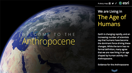
In the realm of digital data and information, a relatively new medium called the “story map” offers valuable assistance in telling a specific and compelling story. A story map allows scientists to share not only data, but also photos, videos and even sounds, all within the framework of a digital map. Story maps are created with Web map applications that provide the user with sophisticated cartographic functionality that does not require advanced training in cartography or geographic information systems, usually coupled with data needed to tell the story. Users can also leverage their own data (including workflows and use cases) in new ways to inform, educate and inspire decision-makers on a wide variety of issues.
The illustration below shows the opening page of a Smithsonian Institution story map depicting human influence on our planet and innovations that are helping to promote sustainability.
3. Be open to partnerships
Climate science, resilience studies and ecology are squarely in the realm of academia and government agencies, but it’s critical to partner with industry as well. The private sector is often looking to create and share knowledge toward solving environmental challenges in partnership with academia or government. Many companies are entering into a culture of resilience not only as part of their values or worldview, but also because it is good business.
Public–private partnerships are most successful when based on a holistic strategy that addresses specific community needs. For example, in June 2013, President Obama announced the Climate Data Initiative, which encourages innovators from the private sector and the general public to share data on climate change risks and impacts in compelling and useful ways that help citizens, businesses and communities make smart choices in the face of climate change. Similarly, NOAA has created cooperative research and development agreements with Amazon, Microsoft, Google, IBM and the Open Commons Consortium. These industry partners in turn share data with smaller companies such as AccuWeather, Esri (where I work) and PlanetOS to extend the public–private partnership even further. On a smaller scale, the new Research Data Alliance is fostering public-private partnerships to enhance data use, data quality and the adoption of data-sharing approaches and tools.
Communities around the world face increasing challenges from natural and manmade disasters. Whether they face drought or flooding, economic collapse or epidemic, communities need digital information technologies to prepare ahead of time, to operate effectively during events and to recover quickly. For digital technologies to meet this need, they too must be resilient. By sharing workflows and use cases, telling compelling stories, and building private-sector partnerships, we can help ensure that digital resources are able to provide the information we need to effectively respond to challenges wherever and whenever they arise. ![]()
Editor’s note: The views expressed here are those of the author and not necessarily of Ensia. We present them to further discussion around important topics. We encourage you to respond with a comment below, following our commenting guidelines, which can be found here. In addition, you might consider submitting a Voices piece of your own. See Ensia’s “Contact” page for submission guidelines.
Ensia shares solutions-focused stories free of charge through our online magazine and partner media. That means audiences around the world have ready access to stories that can — and do — help them shape a better future. If you value our work, please show your support today.
Yes, I'll support Ensia!