June 6, 2018 — The sun beats down on the dried Tanzanian soils. Dust is slowly settling back down to the ground in the wake of a parade of tourists’ vehicles, which are now disappearing over the horizon. It’s dry season in the Serengeti National Park, and safari trucks are groaning under the weight of excited visitors.
The park, a World Heritage Site, draws tourists from all over the world. Its ecosystem is carefully managed by hard-working park rangers — a delicate balancing act between wildlife promotion and preservation made even more daunting by poachers in pursuit of the endangered eastern black rhino.
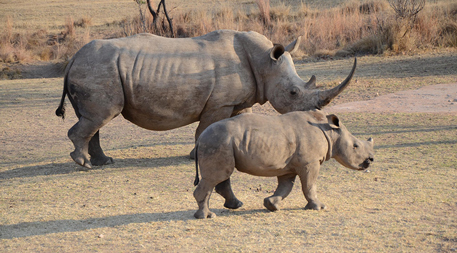
Protecting rhinos from poachers has always been an integral part of park management. While it’s still a complicated and highly skilled endeavor, it’s been made a little easier thanks to recent advances in data communications technology. Using geolocation sensors implanted in the rhinos’ horns and novel wireless telecommunications technology known as a low-power wide-area network (LPWAN), rangers can track the Serengeti’s rhinos from a central location, then concentrate their surveillance efforts where the animals are at any given time.

LPWAN technology helps rangers in Serengeti National Park keep tabs on rhinos and so better focus anti-poaching surveillance. Photo courtesy of Smart Parks
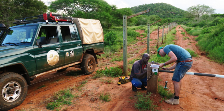
“If you have the information on where the animals are, then you can guide the protection to them,” says Laurens de Groot, co-founder of Smart Parks, which is applying the technology at Serengeti. “We can place the sensors on tourist vehicles, fences, water level measures, rangers — you can see everything you need from one control room.”
De Groot and his organization have been working on optimizing data communications systems used in wildlife conservation — including the Serengeti project — for five years.
“Our aim is to make everything in the park measurable, so the manager knows how to anticipate certain circumstances,” he says.
The LPWAN Edge
From wildlife conservation to oceanography, every single aspect of environmental science and management has a common factor at its heart: data. These data vary enormously across disciplines and projects, not just in the form they take, but by how they are collected.
https://youtu.be/eWVpX6l0gwA
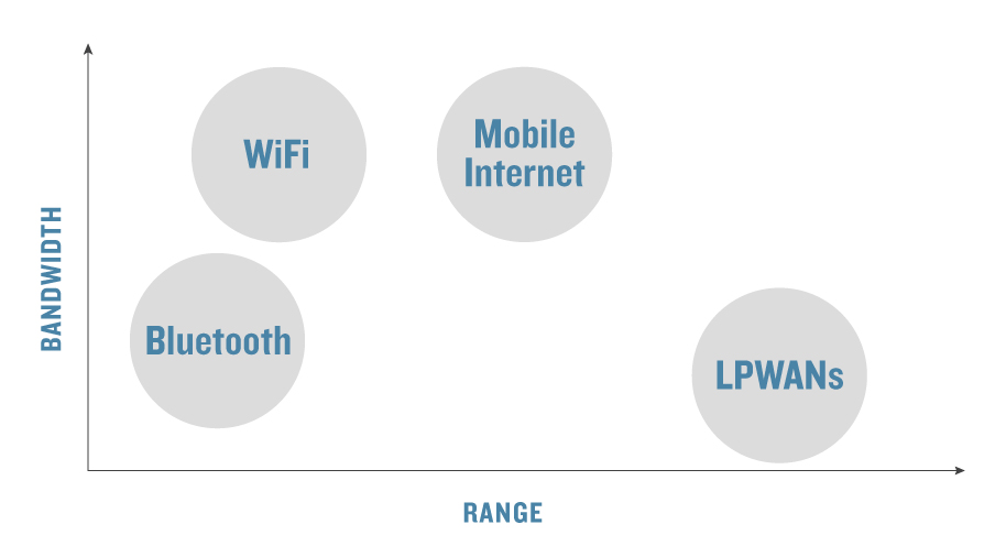
In the last few years, LPWANs have shaken things up significantly in the data collection world relative to the better-known data collection and transmission tools of WiFi, Bluetooth and mobile internet. WiFi and Bluetooth have a limited range of around 30–50 meters (100–150 feet) and 10 meters (35 feet), respectively. Mobile internet has great range and can carry data at the high rate required to support voice calls, video and image sharing, but it requires a huge amount of power.
Because LPWAN uses low radio frequency bands, it can send and receive data across 5 kilometers (3 miles) in a built-up city area and up to 150 kilometers (95 miles) without any obstacles. While most of us have to recharge our phones once a day, the batteries in LPWAN devices can last up to a decade. And though the technology can’t handle the data a mobile phone can, it’s powerful enough for communicating sensor data, which is typically just a small collection of numbers, such as temperature, speed and density.

LPWAN technology has advantages over other communication technologies under certain circumstances because it can convey a limited amount of data over longer distances using less power.
This combination of distance and low power needs makes the technology ideal for application, not only to tracking endangered species, but for other conservation and environmental protection work as well.
Reducing Conflict
LPWANs can be used to reduce conflict between wildlife and people, too. In Assam, India, Smart Parks is installing smart sensors on fences bordering farmland and communities. When an elephant shows up, the sensor alerts people to its presence. The rangers can then scare the animal away, preventing damage to communities and crops.
“We’re using human-made technology in order for reserves and animals to have as little interaction with humans as possible,” de Groot says.
Some have expressed concern that poachers could co-opt LPWANs and use them to find and steal animals. But de Groot isn’t worried.
“In 2018, it’s almost ridiculous to say something can’t be hacked. But our data are very well encrypted, and the signal is sent on such low power that you’d need to be highly skilled to even detect it, let alone decrypt and read it,” he says. “By that point, the animal you were tracking would probably have moved on anyway.”
Controlling Pollution
Meanwhile, in Dublin, Ireland, engineers, academics, telecommunications providers and local government have teamed up to demonstrate the potential power of LPWANs in optimizing water services. Nimbus Research Centre in Cork has deployed sensors along the River Liffey to gather data on water depth, temperature and velocity.
These data can be used to inform decisions around infrastructure planning and maintenance, such as installing energy-saving valves [and] repairing leaks. “The idea is to integrate this with other data feeds from various sensors — so you can imagine rainfall sensors, flow sensors, all integrated together,” says center water coordinator Kevin Fitzgibbon. These data can be used to inform decisions around infrastructure planning and maintenance, such as installing energy-saving valves, repairing leaks, cleaning up pathogens, and optimizing water recycling.
Another huge area for application for LPWANs is in agriculture, where the technology can help farmers do their jobs more sustainably.
European Union regulations around soil fertilization are fairly broad — farmers can spread fertilizer any time between March and October — and it’s not uncommon for it to end up polluting water in addition to nourishing crops.
LPWAN technology could make it easy to gather data — soil moisture, water phosphorus levels and air moisture — and feed them into an app. “You’d have a platform for an operator or a technician to say, ‘Don’t spray now, your ground is water logged, there’s a spike in water phosphorus levels,’” Fitzgibbon says. “Then a message could be pushed out when the conditions reach optimal levels.”

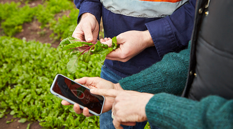
Australian farmers are using LPWAN to measure local conditions and use them to decide when to irrigate, fertilize and harvest their crops. Photo courtesy of The Yield
An Australian business, The Yield, has already developed technology and analytical frameworks very similar to those Fitzgibbon imagines. It’s produced a service for farmers that integrates sensor data from the ground with local weather conditions. Sensors deployed by the company can measure temperature, humidity, barometric pressure, wind speed and direction, and more. This allows customers to base decisions around irrigation, fertilization and harvest on accurate, highly localized data so they can not only save time and money, but avoid wasting resources.
“We know we need to be able to farm better — to produce the right amount of yield so we can avoid gluts and wastage which we see so often in the agricultural world,” explains Felicity Turner, general manager of customer experience.
Farmers don’t have to err on the side of caution quite so often.The Yield is sharing data it gathers with researchers at the University of Technology, Sydney, who are working on crop and livestock disease prediction models. They’ve been particularly focused on Pacific oyster mortality syndrome (POMS), a viral disease estimated to have cost the Australian state of Tasmania US$4.2 million during one 2016 outbreak. Because of the huge risk POMS poses to oyster crops, farmers can be forced to close their farms when they notice even slight changes in water quality. In using a wide array of data feeds, such as salinity and water temperature, to build an accurate prediction model, farmers don’t have to err on the side of caution quite so often.
Who Will Pay?
If LPWAN is so valuable, why aren’t more people using it?
“The biggest barrier to adoption of LPWAN is — who is going to pay for the infrastructure?” Fitzgibbon says.
This infrastructure is extremely cheap compared to other telecommunications networks, such as WiFi and cell phone coverage. But it still needs to come from somewhere. For LPWAN usage to be widespread and accessible, base stations, also known as gateways, need to be installed and maintained across the desired coverage distance of the network of sensors being used to collect the data.
The future of LPWANs in sustainability and environmental management clearly lies in the hands of those who have the money and power to make it happen. Some World Heritage Sites and research facilities might have the resources to support these tech solutions, but smaller scale projects may not. Worldwide, some local governments and corporations are already working on developing LPWAN infrastructure — but these bodies are not always inclined to make it openly accessible.
The future of LPWANs in sustainability and environmental management clearly lies in the hands of those who have the money and power to make it happen. That means proponents of the networks need to be just as business-wise as they are tech-savvy.
“How do we commercialize these ideas to make this a reality?” asks Fitzgibbon. “The technology is capable of doing many things, but if it doesn’t have a business case, it will only ever be a demonstration project.”
One thing is certain: If the resources are available to deploy the technology, countless opportunities await to apply it to shaping a healthier environment around the world. ![]()
Ensia shares solutions-focused stories free of charge through our online magazine and partner media. That means audiences around the world have ready access to stories that can — and do — help them shape a better future. If you value our work, please show your support today.
Yes, I'll support Ensia!
