
December 11, 2012 — It’s January, and bitterly cold in Minneapolis. This time of year, there aren’t many places you can call up and gloat about Minnesota weather, but Antarctica really ought to be one of them.
“Oh, it’s 32 and sunny here,” says Claire Porter, a University of Minnesota graduate student working on the ostensibly frozen continent. “We spent the whole day outside hiking and playing around.”
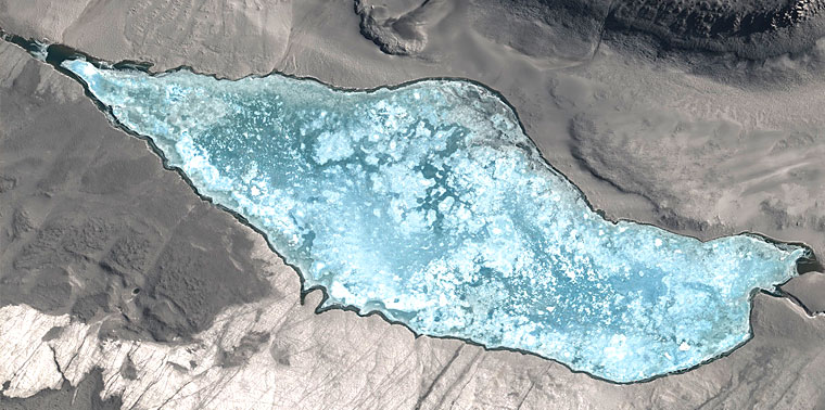
Antarctica, as it turns out, defies all sorts of expectations. Far from a blank, white canvas, the bottom of the world is a beautiful place, full of breathtaking peaks and stark, rock-strewn valleys studded with cerulean lakes. But the things that make Antarctica so fascinating—and such an important center for scientific research—also make it a difficult place to work. Porter is part of a team of scientists whose job is to make other scientists’ jobs easier.
From tracking penguins and mapping unique geological features, to making sure satellite Internet connections aren’t blocked by an inconvenient mountain, the Antarctic Geospatial Information Center has a finger in just about every research pot. Amazingly, it does all this on a budget of less than $500,000 a year, and a staff of only 10, most of them graduate students.
Paul Morin, the center’s director, came from the world of data visualization—he’s written textbooks, worked with science museums and helped the National Center for Earth-surface Dynamics better understand changes in river system ecology. He started the AGIC two years ago.
“The highest form of life in these places is nematodes,” says Morin.
“Our grant is to provide geospatial support for the U.S. Antarctic research program. The majority of people down there need help with geographic information systems, cartography, remote sensing or some kind of analysis,” he says. “A lot of this is mapping, and mapping is just a form of visualization.”
While the big picture was familiar territory for Morin, the details of working—and even, for short stretches, living—in Antarctica have been a very different experience. In mid-December, he was about to set off on his third trip to Antarctica. He stays about a month each time. Going to the continent with the National Science Foundation is a lot like going to space with NASA, he says: You basically show up with your computer and some clean underpants, and the rest is taken care of.
The NSF sends Morin and his team plane tickets to New Zealand, issues cold-weather clothes, shuttles them to Antarctica in a military C-17 transport and outfits them on arrival. “Everybody needs gear down there and not everybody is from Minnesota,” he says. “They have a facility in Antarctica called the Berg Field Center, and it’s basically REI. You go in and you say, ‘I need this tent, I need this food,’ and they know everything about it.”
Thanks to that system, Morin and his team are left without much to worry about besides their work. That’s good, because supporting almost all the research in Antarctica is a time-consuming task, which can even take the AGIC team outside the heated, catered confines of McMurdo Station and into the Antarctic frontier.
This year, Morin and his crew were preparing to camp in Antarctica’s McMurdo Dry Valleys—a place that serves as an analog for Mars on Earth. As the name implies, there’s little snow in the dry valleys. There’s also very little life, just cyanobacteria and the occasional seal that wandered in and died.
“The highest form of life in these places is nematodes,” says Morin.
AGIC is going there for several reasons. First, they’ll set GPS points and match them to their maps and huge database of satellite images, so researchers will have a more accurate understanding of just where it is they’re looking at. Along the way, they’ll also map the rare wet patches in these valleys—such as Don Juan Pond, the saltiest lake in the world. That information will help scientist who study extreme forms of life know where to look for them.
But not all their work is in the field. Recently, AGIC was given access to images of Antarctica, taken by the same satellites that do intelligence imaging for the U.S. government.
“Because the orbits of these satellites come together at the poles, I can shoot every point in Antarctica up to three times per day, per satellite,” Morin says. “There’s no competition because nobody using them wants to see Antarctica but me. And each pixel is between 50 centimeters and 1 meter. I’m getting between 200 and 500 gigabytes of data every day.”
The images are in exquisite detail. The hard part is figuring out how to organize, store and actually put the information to productive use. It’s an overwhelming task, but Morin and his team are starting to get the hang of it. One of the ways they’ve used the images is to help penguin researchers find colonies of the birds and track their movements.
How do you find penguins on a satellite image? “Even with this level of detail, it’s hard to spot the birds,” says Morin. “So what we do is look for reddish-brown smears on the snow—trails of penguin poop—and follow those back to the colonies, which you can see because it’s just a huge spot of poop.”
This article originally appeared in the Winter 2010 issue of Momentum magazine, Ensia’s predecessor.
Ensia shares solutions-focused stories free of charge through our online magazine and partner media. That means audiences around the world have ready access to stories that can — and do — help them shape a better future. If you value our work, please show your support today.
Yes, I'll support Ensia!